
Apollo Mapping @ApolloMapping
The Image Hunters: High/med-res satellite imagery providers passionate about remote sensing, GIS, space, tech, geography, geology and Star Wars. Bike nerds. apollomapping.com Boulder, CO Joined December 2011-
Tweets9K
-
Followers2K
-
Following1K
-
Likes16K
#AudiField from above! For more photos from a bird's eye view of our beautiful Earth, check out our #ImageHunter tool at imagehunter.apollomapping.com

Saint Maarte from a satellite view is gorgeous! For more stunning high-resolution satellite imagery, check out our #ImageHunter tool at imagehunter.apollomapping.com #satelliteimagery #aerialimagery #mapping #satelliteview #worldfromabove

This iconic Turin landmark, once a hub of automotive innovation, features a rooftop test track like no other. Explore high-res satellite imagery with Image Hunter 🔎 Try it now: imagehunter.apollomapping.com #FiatLingotto #Turin #GIS #EarthObservation #Mapping

Explore Copenhagen from space! 🛰️ Want more high-res satellite imagery? Image Hunter lets you search, preview, & order the best data for your projects. 🔎 Try it now: imagehunter.apollomapping.com #Copenhagen #GIS #EarthObservation #Mapping

Check out this stunning #SatelliteView of the #OaklandCAShipyard! 😍 With our incredible #ImageHunter tool, you can explore over 200 million more breathtaking #SatelliteImages and #AerialImages. Dive in now at imagehunter.apollomapping.com

Exploring urban development and infrastructure of #NakuruKenya from a new perspective. See over 200 million more images from a #satelliteview with our #ImageHunter tool at imagehunter.apollomapping.com


The #KenyaCoastline looks gorgeous from a #BirdsEyeView! Our #ImageHunter tool includes over 200 million other images like this one! View it at imagehunter.apollomapping.com

Look at this awe-inspiring beautiful #satellimagery of #GranadaSpain! Wanna see more fantastic #aerialimages and #satelliteimages? Check out our #ImageHunter tool at imagehunter.apollomapping.com

#BrooksRange in #NorthernAlaska from a #satelliteview looks beautiful! Our #ImageHunter tool has millions of other great #aerialimagery and #satelliteimagery in its collection! Check it out at imagehunter.apollomapping.com

Exploring nature from above—check out this aerial view of beautiful landscapes and tranquil waters of #SpringFieldIL! Our #ImageHunter tool has loads of other great #satelliteimages and #aerialimages! imagehunter.apollomapping.com #NaturePhotography #AerialView #BirdsEyeView

Ibiza Spain from a bird's eye view is gorgeous! We have tons of other beautiful #satelliteimages and #aerialimages in our #ImageHunter tool! Check it out at imagehunter.apollomapping.com #IbizaViews #SpainTravel #DronePhotography #TravelInspiration #BeautifulDestinations

Check out this awe-inspiring #satelliteimagery of #Brussels! Our #ImageHunter tool has millions of beautiful #satelliteimages for you to see! Check it out at imagehunter.apollomapping.com #TravelPhotography #ExploreTheWorld #AerialView #NatureLovers #UrbanExploration

A stunning aerial view showcasing the unique blend of architecture and nature of Huntsville AL from above! Check out our #ImageHunter tool for even more fantastic #satelliteimagery! imagehunter.apollomapping.com #HuntsvilleArchitecture #NatureLovers #AerialPhotography #UrbanParadise

This #aerialview of #LittleRockBarge is fantastic! Check out our #ImageHunter tool for more great #satelliteimagery and #aerialimagery! Image Hunter has millions of images and we're adding more regularly! imagehunter.apollomapping.com

Exploring the vibrant cityscapes from above! Which spot would you like to visit first? 🌆✈️ See even more gorgeous #aerialimagery with our #ImageHunter tool at imagehunter.apollomapping.com #UrbanExploration #CityViews #SkyHighShots #TravelInspiration #DronePhotography


A stunning aerial view capturing the patchwork of fields and surrounding greenery—nature's artwork from above. Check out our #ImageHunter tool for more fantastic #satelliteimagery! imagehunter.apollomapping.com #AerialPhotography #NatureLovers #LandscapePhotography #OutdoorBeauty

A breathtaking aerial view of lush greenery and winding waterways, showcasing nature's intricate patterns. Our #ImageHunter tool has even more beautiful #satelliteimagery! imagehunter.apollomapping.com #NaturePhotography #AerialView #GreenLandscapes #WaterwayWonders #NaturePatterns

Exploring the beauty of patchwork fields from above. Nature's artistry at its finest. Take a look at the other fantastic #satelliteimagery in our #ImageHunter tool. imagehunter.apollomapping.com #AerialPhotography #NatureLovers #LandscapePhotography #DroneView #EarthFromAbove

Exploring urban landscapes from above – a captivating view of city life, industry, and sports coming together. Our #ImageHunter tool has even more great #AerialImagery! imagehunter.apollomapping.com #UrbanExploration #CityViews #DronePhotography #SkylineShots #AerialPerspective


Exploring the beauty of nature from above, where artistry meets agriculture. 🌿✨ #AerialView #NatureLovers. Check out our #ImageHunter tool for more great #satelliteimagery! imagehunter.apollomapping.com #DronePhotography #LandscapeLovers #NaturePhotography #EarthFromAbove


Simon Kuestenmacher @simongerman600
265K Followers 215K Following German #geographer and #demographer in #Melbourne. I curate #maps and #data that explain how the #world works. Obviously all opinions are my own...
Planet @planet
262K Followers 4K Following We see the whole world, every day. Using space to help life on Earth. 🛰️ $PL
Vantor @vantortech
139K Followers 837 Following Vantor is forging the new frontier of spatial intelligence to unlock a more automated, interoperable world. Delivering total clarity from space to ground.
Sisters of SAR @SistersofSAR
10K Followers 4K Following A passion for all things #SAR | #WomeninSAR | @eoscenefrom | We 💜@LadiesofLandsat & @DamesofDrones| Tweets by @LDR1, @SAR_ahBanks, @Go__Pika & @ant_dasgupta |
Dr Robbi Bishop-Taylo... @SatelliteSci
8K Followers 5K Following Posting at 🦋. Earth Observation Scientist at @GeoscienceAus. Using satellites 🛰️ to study the earth 🌍 through space and time
Nicholas Duggan @Dragons8mycat
4K Followers 2K Following I never chose 🌍GIS, 🌍GIS chose me, Spatially Literate F1 fan & father. Holder: https://t.co/aoe140H4Gu
Geospatial World @geospatialworld
32K Followers 3K Following Your trusted knowledge source for all things geospatial. We delve into tech convergence and pivot to Industry 4.0 via Digital Transformation and Sustainability
themapguy.bsky.social @CharlesRobbins
2K Followers 1K Following The ‘Map Guy’ Civil Servant in the US and as such, I support EVERYONE who is a citizen of the city, county, state, country, and world. In that order generally.
OpenTopography @OpenTopography
10K Followers 582 Following Open access to high-resolution, Earth science-oriented topography data, and related tools & resources. US NSF supported. #lidar
Geospatial Profession... @URISA
10K Followers 3K Following The Geospatial Professional Network (formerly URISA) is a community of emerging and experienced GIS professionals.
@rjhale1971@fosstodon... @rjhale
4K Followers 3K Following Owner of @northrivergeo . Enjoys adventuring, canoeing, and long walks on the beach while fixing data. #QGIS #POSTGIS #GDAL #GEOSERVER #CHATTANOOGA #HASHTAG
SpaceWill Info. Co., ... @spacewillinfo
828 Followers 217 Following Commercial imagery provider and marketing operator of SuperView constellation and authorized imageryprovider of Chinese imaging satellites (GF, ZY and HJ).
Southern Fire Exch. @SEFireScience
3K Followers 381 Following The Southern Fire Exchange is the JFSP regional wildland fire science delivery program supporting managers and researchers in the southeastern United States.
Jalal @JAlkhobi
7 Followers 191 Following
Tony @Tony12522738868
17 Followers 82 Following
Imad @Imad56661604
325 Followers 7K Following
Luca Ferrari @LucaFerra96
149 Followers 474 Following PhD student @eth_en @usys_ethzh | Environmental Engineer and modeller @polimi | 🇮🇹🇦🇹🇵🇱🇨🇭 | He/Him
DeltaXray_1 @1Deltaxray
1 Followers 170 Following OSINT and Imagery Analyst| Naval affairs and maritime geopolitics

DAVID STRONG @DAVIDST92590224
29 Followers 961 Following
عبدالله الم... @oo__vv
310 Followers 670 Following Cyber🚦Security_🇸🇦 | PenTest🩻 | OSINT_Researcher🕵🏻♂️ | Malware Analysis ⚒️ | And I still learn💻 _ 📚 _

Dr. Rao Mansor Ali Kh... @raomansor
46 Followers 540 Following
Mehmood Alam @SpatialMehmood
1 Followers 58 Following M.Eng. in Remote Sensing & GIS | @AITAsia graduate 🌍
Jack Grand @JGrand32252
0 Followers 23 Following
Kourm @Koukou4465
7 Followers 1K Following


SFL Missions @sflmissions
42 Followers 1K Following SFL Missions of Toronto develops microspace missions providing bigger returns from smaller satellites at low cost.
AS-22 @AS_22im
6K Followers 619 Following ロシア軍が構築している塹壕をデータ化してました。 紛争、自然災害等も衛星画像を使って観察してます。IMINT,OSINT,GEOINT
Bls espain Mohamed @bls_espain
9 Followers 307 Following
Nons Senses @sen6298
0 Followers 29 Following
Geoconsult @InfoGeoconsult
45 Followers 242 Following Geotecnologia e Mudanças Climáticas / Geospatial and Climate Change


An Nguyễn @AnNguyn92368092
56 Followers 2K Following


Chris Lathrop @viaChrisLathrop
254 Followers 553 Following 2023 Las Vegas UFO Encounter Investigator, Investor, Researcher, Gardener, Heirloom Seed Slinger, Avid Reader… 🕵️♂️💰 🌱 🛸 📚
3Ser @3SerRS
39 Followers 1K Following Remote sensing scientist. Remote Sensing MDPI Guest Editor 🌎🛰️. Special Issue Call for Paper (CfP) below: 👇👇👇
Luis @luis_ES_0034
1 Followers 1K Following
arr @arr55005
3 Followers 108 Following
Ali A. Abbas @aliadnanabas
22 Followers 584 Following Visionary Leader • Founder of Refco, Project Director | Urban Dev & Sustainability Advocate 📍 Baghdad | MSc in Geomatics Building Iraq’s future.
ISAXON @isaxonWorldwide
249 Followers 2K Following Award winning | GIS & RS Consultant | Wits Alumni | ENKORP Consultancy
Md Omor miya @miya_md92184
45 Followers 1K Following
Dipti Singh @diptivsingh
4K Followers 2K Following Journalist @MumbaiMirror former @mid_day , @fpjindia @IndianExpress & @DNA , Typical #Mumbaikar & a #SherlockHolmes fan 😎 [email protected]
Matthew Stotts (🌊,... @mlstotts
7K Followers 7K Following Investing in Earth-scale technologies for climate impact, sustainability and regeneration. Слава Україні 🇺🇦
Lost @Lost17760704
203 Followers 374 Following HiddifyManager VPN 简化服务器的搭建过程,即使使用移动设备也能轻松管理。您可以轻松地与家人、朋友、群组甚至数百名用户共享代理。
地理探险家 @tanxianjiabiao
0 Followers 63 Following
開発くん🛰️ @jp_consultant
2K Followers 850 Following 途上国支援から衛星データ利用の道へ。SARに夢中。元々の専門はEBPMと事業評価 | 衛星データ業界のどこか←衛星データ会社←某援助機関←開発コンサル会社(事業評価) | 書籍『SAR衛星データ解析入門』(講談社) | Kaggle https://t.co/D2Pzad3sep 全ポストは個人の見解
munnavai @munnavai132262
141 Followers 698 Following
DJI Dronie Pro @DJI_Dronie_Pro
8 Followers 81 Following 🌍 Stunning aerial shots of nature & wildlife 🚀 #DroneVideos #AerialCinematics
Ashay Deo @ashay_deo28
0 Followers 10 Following

MD mizanur Rahman @MDmizan5977551
127 Followers 2K Following

TVIS - Anna Tashuk @AnnaTvis
0 Followers 7 Following
Balaram kumbhakar @Balaramkumbhak6
7 Followers 383 Following Remote sensing and gis || Data Science || LiDAR || Machine Learning


ESA Earth Observation @ESA_EO
144K Followers 3K Following @esa #EarthObservation: Taking the pulse of our planet from space. Please see our Privacy Notice: https://t.co/zzMYcxj8xi
Copernicus EU @CopernicusEU
137K Followers 2K Following The Earth Observation component of the EU Space Programme
NASA Earth @NASAEarth
3.7M Followers 86 Following NASA’s favorite (habitable) planet. 🌎💚 Studying Earth from ground to orbit.
Will Marshall @Will4Planet
26K Followers 843 Following Co-Founder & CEO of Planet -- building little spaceships to help us to take care of our favourite spaceship, the Earth :)
Planet @planet
262K Followers 4K Following We see the whole world, every day. Using space to help life on Earth. 🛰️ $PL
ARCHIVED - NASA Lands... @NASA_Landsat
76K Followers 431 Following We’ve moved! Visit https://t.co/ObKiWKvAMz or follow @NASAEarth & @NASAGoddard for future Landsat updates.
Vantor @vantortech
139K Followers 837 Following Vantor is forging the new frontier of spatial intelligence to unlock a more automated, interoperable world. Delivering total clarity from space to ground.
ESA Operations @esaoperations
331K Followers 754 Following From Earth orbit to deep space: sharing the excitement of realtime mission operations at the European Space Agency 🛰🕹️ Home of Space Safety 🛡️💙
Dr Robbi Bishop-Taylo... @SatelliteSci
8K Followers 5K Following Posting at 🦋. Earth Observation Scientist at @GeoscienceAus. Using satellites 🛰️ to study the earth 🌍 through space and time
Nicholas Duggan @Dragons8mycat
4K Followers 2K Following I never chose 🌍GIS, 🌍GIS chose me, Spatially Literate F1 fan & father. Holder: https://t.co/aoe140H4Gu
Canadian Space Agency @csa_asc
361K Followers 1K Following The Canadian Space Agency coordinates all civil, space-related programs on behalf of the Government of Canada. Terms: https://t.co/58Nfe1GL0V (Français @asc_csa)
USGS @USGS
767K Followers 94 Following Science is only a tweet away. Tweets do not = endorsement: https://t.co/VoRuucTNuK
Geospatial World @geospatialworld
32K Followers 3K Following Your trusted knowledge source for all things geospatial. We delve into tech convergence and pivot to Industry 4.0 via Digital Transformation and Sustainability
themapguy.bsky.social @CharlesRobbins
2K Followers 1K Following The ‘Map Guy’ Civil Servant in the US and as such, I support EVERYONE who is a citizen of the city, county, state, country, and world. In that order generally.
SpaceNews @SpaceNews_Inc
141K Followers 274 Following Since 1989, SpaceNews has set the authoritative standard for independent space journalism. Subscribe to our newsletters: https://t.co/OurpSOmMeN
MapScaping @MapScaping
36K Followers 114 Following The MapScaping Podcast is a #podcast for the #geospatial community. Just search for "MapScaping" Wherever you get your podcasts!
MapPorn @MapPornTweet
78K Followers 2K Following Official Twitter account of /r/MapPorn. Reminder: There are high-resolution images of the maps if you follow the Reddit links.
@rjhale1971@fosstodon... @rjhale
4K Followers 3K Following Owner of @northrivergeo . Enjoys adventuring, canoeing, and long walks on the beach while fixing data. #QGIS #POSTGIS #GDAL #GEOSERVER #CHATTANOOGA #HASHTAG
Southern Fire Exch. @SEFireScience
3K Followers 381 Following The Southern Fire Exchange is the JFSP regional wildland fire science delivery program supporting managers and researchers in the southeastern United States.
Masih Alinejad 🏳�... @AlinejadMasih
831K Followers 2K Following Iranian Journalist & Activist | President of @WLCongress | Founder of #WhiteWednesdays, #MyCameraIsMyWeapon, #MyStealthyFreedom | زن زندگی آزادی

Brad Underwood @CoachUnderwood
62K Followers 391 Following University of Illinois Head Men's Basketball Coach #Illini #EveryDayGuys
King Kofi @kxng_alpha
24K Followers 55 Following humble and hungry R.I.P pops 🙏🏾 watch me shock the world 🌎 👻 - kxngkofi Instagram - kingkofi21 NIL - [email protected]
Derek Law @GIS_Bandit
6K Followers 1K Following Product Manager @Esri | Interests #GIS, #HealthGIS, #Maps, #DataViz Please find me on Bluesky and Mastodon as "GIS_Bandit" Comments are my own.
National Library of S... @natlibscot
53K Followers 3K Following Scotland's national library. A treasure trove of Scotland’s knowledge, history and culture.
Turquoise Geo @TurquoiseGeo
365 Followers 1K Following Remote sensing / télédétection solutions, consultants, ENVI, IDL, ENSOMosaic, images, #ENVI, #ENVILIDAR, #ENVIFX, #IDL, #SARSCAPE
Bodleian Libraries @bodleianlibs
105K Followers 1K Following Amazing collections and breath-taking libraries. Facilitating research at the University of Oxford. Visit | Read | Explore

EUSI @EUSPACEIMAGING
6K Followers 655 Following 🛰 Satellite imagery for Europe and North Africa 📸 Native resolution up to 30 cm ⏳️ Near real-time delivery up to 15 min after collection
EOS Data Analytics @eos_da
3K Followers 444 Following EOSDA is an AI-powered satellite intelligence provider that transforms raw multi-sensor data into trusted outcomes.
Neil Kaye @neilrkaye
16K Followers 299 Following Climate data scientist @metoffice specialising in generating interactive websites and bespoke #dataviz. #climate #maps #GIS #mapping #Rstats Views are my own
EARSC @earsc
7K Followers 1K Following European Association of Remote Sensing Companies. Our mission is to foster the growth of the #Earthobservation services sector in Europe.
Earth Lab CU-Boulder @EarthLabCU
4K Followers 1K Following We harmonize Earth observations from ground to space to address global change & help society adapt. @cuboulder #earthanalytics
Daniel Donner is only... @donnermaps
3K Followers 516 Following Contributor at The Downballot. Data, maps, and demographics. Find me at https://t.co/q6ruEqSwu0. US Politics Starter Pack: https://t.co/0mPrN8SkdW

David Gross (SLUSHY.c... @grossnasty
6K Followers 1K Following Co-Founder: https://t.co/QrI3kLkWeI, SolveBio (acquired), https://t.co/00bGmra1m0 (acquired), https://t.co/kfgswA5QYD (acquired). Get in touch https://t.co/lIObPg8VaV

Illinois Men's Basket... @IlliniMBB
182K Followers 390 Following Official Twitter account for the University of Illinois Men's Basketball team led by @CoachUnderwood.
GIS Resources @GISResources
2K Followers 0 Following GIS Resources is global platform for geospatial latest news & insights, developments, jobs, webinars, articles, data, conferences and tenders.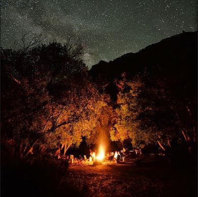
Pat Collins @collins_GIS
111 Followers 135 Following GIS, Remote Sensing, Rafting, Snowboarding, and everything else that is Colorado...
GIS @ Claremont @claremontGIS
438 Followers 509 Following Claremont Colleges | GIS GPS Support at Libraries ¦ Promoting spatial literacy within the 5C. & Oh yes, tweets are my own
OSGeo https://fosstod... @OSGeo
30K Followers 186 Following The Open Source Geospatial Foundation... search for our local chapters around the world as well. See you at https://t.co/mCjhOCQaoy
James Boxall (flying ... @JamesGIS
4K Followers 665 Following FRCGS FRGS (hint: geographer) Tweets may offend most. Between apoplectic & adorable. The wrong demographic. and I shake like shit. https://t.co/rsppChRzVz
GIS Web Maps @giswebmaps
5K Followers 110 Following Tweeting GIS & Web Mapping Applications from around the world. What makes them good, what makes them bad and links to some examples
Christopher Thomas @GIS_Advocate
3K Followers 203 Following Early adopter of GIS and IT|Always looking to identify new trends|Enjoys learning of others success|Loves innovators
The GIS Forum @thegisforum
6K Followers 541 Following The GIS forum twitter feed will be used to aggregate site posts and provide some quick site updates. It is monitored, but will probably not be very 'personal'.
ProvidenceGIS @ProvidenceGIS
284 Followers 431 Following More than a Map #GIS #SmartGrid #ElectricUtilities #SmartMeters #GreenButton #Utilities #Cloud #CloudComputing
Estudios Gis @estudiosgis
5K Followers 497 Following Más de 25 años innovando en Sistemas de Información Geográfica, Desarrollo de aplicaciones geográficas. Gestión y telegestión de activos. Inventarios.
Remote Sensing MDPI @RemoteSens_MDPI
23K Followers 887 Following Remote Sensing (ISSN 2072-4292) is an #openaccess journal, published semimonthly by @MDPIOpenAccess; IF 2025 4.3; CiteScore 2025 9.4; #mdpiremotesensing
GEOGRΛMΛ @Geograma_
6K Followers 672 Following Capturamos e integramos #geodatos , para mejorar las decisiones de tu organización - #GIS, #location Intelligence
Geo at Springer @SpringerGeo
11K Followers 5K Following News and updates from Springer's Earth Sciences, Geography and Urban Studies Programme
350 dot org @350
335K Followers 17K Following International movement working to end the age of fossil fuels & build a world of community-led renewable energy for all. Now on Bluesky: @350org.bsky.social
Climate Desk @ClimateDesk
140K Followers 825 Following A journalistic collaboration dedicated to exploring the impact—human, environmental, economic, political—of a changing climate. Follow https://t.co/obnKBDp0LS
Climate Power @ClimatePower
221K Followers 1K Following Fighting for bold climate action, exposing Big Oil’s greed, and holding polluters accountable⚡️
Will Cadell @geo_will
4K Followers 3K Following I could be skiing, I could be climbing. There might be code; there might be data. Continually amazed by the #geospatial magic created by my team at @sparkgeo
GEO Jobe @GEOjobeGIS
4K Followers 1K Following ArcGIS solutions provider and custom software developer of Admin Tools, Clean My Org, Backup My Org, Symphony, and Manage My Attachments. Esri Platinum Partner.
abdi @abisto10
312 Followers 4K Following “لا ترى العين عيبا.. اذا أحب القلب قلبا” — The eye does not see a flaw, if the heart loves a heart.
josephkerski @josephkerski
15K Followers 2K Following Geography, geo-geekiness, STEM, ed tech, space, place, geographic information systems (GIS), GPS, outdoor education 365 days a year.
Climate Central @ClimateCentral
130K Followers 7K Following Researching and reporting the science and impacts of climate change. ⚽WORLD CUP HUB: https://t.co/0emBrN7z72
Vivid Maps @VividMaps
16K Followers 5K Following #Maps that will help you make sense of the world. https://t.co/hYkqtedPIU https://t.co/xdV6v8YFRo

MappingGIS 🚀🌍 @MappingGIS
25K Followers 297 Following Formación que impulsa tu perfil GIS. Cursos online de #QGIS #R #IA #PostGIS #python #teledeteccion #GeoServer #OpenLayers #Leaflet #MapStore #MapLibre
Directions Magazine @directionsmag
15K Followers 121 Following Your home for geospatial news, articles, webinars and podcasts since 1998!Geospatial Newsfeed @GeoMurmur
2K Followers 2K Following Mur-mur(noun): low continuous sound as of a brook, the wind, trees, or of low, indistinct voices. Geospatial(adj): relating to positions on the earth's surface
SmarterBetterCities @SmarterBetterC
2K Followers 2K Following We love #3D | Creators of @CloudCities_io | @ClimateKIC #startupYou might like